Origins & History
The Saxon Period
By the tenth century there were a manor and a church at Appledore. Domesday Book indicates that there was also a fairly large secular settlement there by 1086, which probably had its roots in the Saxon period.
The Medieval Period
By 1086, Appledore was a sizeable settlement with a population of c. 300. It also had a church, and a manor held by the monks of Christ Church, Canterbury. Its position on the north bank of the river Limen and the Anglo-Saxon Chronicle reports of Danish raids suggest that it was a small port with riverine access to the sea and to the Weald. The settlement stood at the junction of a road from Ashford via Woodchurch in the north, and an east-west road to Stone in Oxney in the west and Kenardington in the north-east.
Markets and fairs
Although the first market charter is not known until 1358, when both a weekly Saturday market and an annual fair on 1st August were granted, there were shops and stalls in Appledore by the thirteenth century. They belonged to Christ Church, Canterbury in its capacity as lord of the manor, and documents recording repairs and revenues have been preserved. As a result, more is known about medieval commerce in Appledore than in any other small town in Kent.
In 1279 four shops with wooden counters, a shop next to the church and four stalls are recorded; in 1297 there were seven shops and five stalls. The manorial income from renting out the shops reached 18s. in 1321 and remained at that until 1347, but the stalls provided only 18d. annually from 1303 to 1335, and that dropped to 8d. in 1335 when the land behind the stalls was derelict.
In 1349 the effects of the Black Death on Appledore can be inferred from the statement, “nine shillings received from the shops in the town and no more because all the holders who used to be there are dead”. There was further devastation in 1380 when the French sacked the town, and during the rebuilding, fifteen new stalls were erected in the market place and all existing stalls were repaired.
From 1464 shambles (sites for moveable stalls) were leased between the highway and a path leading to the church, on the east side of The Street. In addition to the market stalls, there were shops on the west side of The Street; one is mentioned in a will of 1469. By 1520 the market place had a cross near a pond, and in 1523 money was provided for building a conduit to carry running water to the market.
The market occupied a wedge-shaped area at the south end of The Street and flanking the western boundary of the churchyard, on which it may have encroached. This arrangement is typical of an undefended market town from c. 1100 onwards.
The Manor (now called Hornes Place, with Hornes Place Chapel attached)
Tenth and eleventh century charters (above) indicate that there was a manor at Appledore before the Norman Conquest. It was acquired by Christ Church, Canterbury in 1032, and remained in its possession until the Dissolution.
Until the late thirteenth century the manorial or demesne farm was probably managed by resident monks, but after 1286 a lay official, known as a serviens or serjeant was in charge. One of his responsibilities was to submit annual accounts, some of which have been preserved in the Bedel rolls, now in Canterbury Cathedral Archive. They contain invaluable information about the buildings of the manor, mainly recording when they were repaired. Hall, barn, dairy, mill, kitchen, stable, oxen house and shop are mentioned in the late thirteenth century, and a great barn, a small barn, a granary, at least two lavatories (washing places), two garderobes (latrines), a pantry and a great gate existed in the fourteenth century.
Most of the buildings seem to have been thatched until 1342 when the barn was re-roofed in tile; the chapel roof was tiled in 1350. By 1350 the farm comprised many fine buildings, including a great stone hall with chambers, a kitchen; a chapel with newly tiled roof; several barns a stable, stock sheds, pig pens and a mill.
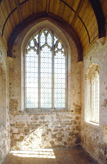
Despite the detailed records of its farm buildings, its precise location is unknown. The most probable site is the area now occupied by Horne’s Place and Gusborne Farm, north-east of the north end of The Street. Today, Horne’s Place has a fourteenth century domestic chapel and there is a mill mound to the south, possibly the remains of the manorial mill. Masonry foundations discovered at the end of the eighteenth century may have formed part of the great stone hall mentioned in 1350. Horne’s Place was attacked and demolished during the Peasants’ Revolt of 1381, but by then the priory had a new demesne farm at the south of the town at Court Lodge.
From 1378 a hall, chamber and barn were erected at Court Lodge. Between 1391 and 1411 they were supplemented by two barns; new stables were built in 1407. All the buildings were destroyed by fire at the end of the fifteenth century, but were rebuilt very soon afterwards and survived until 1885. A modernized aisled barn and a windmill mound are all that remain today.
Port and Water Communications
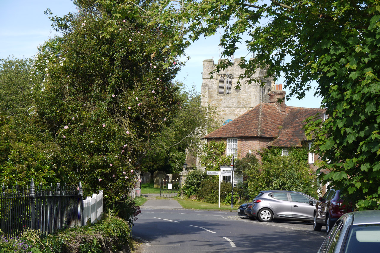
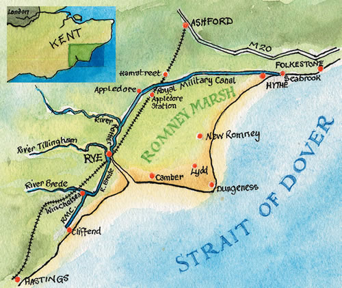
Appledore is a small inland village on the edge of Romney Marsh, c. 10km from the nearest seacoast at Rye Harbour. It is best known today for its proximity to the Royal Military Canal, which is reached by entering from the main road of Appledore (The Street) and passing through the narrow roadway following signs for Rye.
However, Appledore once had a thriving harbour and it is difficult now to imagine today the vital part that navigable water played in the life of the town until the sixteenth century, when the changing course of the river Rother, caused by natural silting, turbulent weather in the thirteenth century, and human intervention in the form of land reclamation, left it high and dry.
When Appledore started to develop before the Norman Conquest its site was a low peninsula, c. 10m above sea level, jutting out into marshy land and skirted by a river, known then as the Limen or Rumenea (later known as “the river of Newenden” and finally to become the river Rother). The river carried the waters from its catchment area in the Weald through the marsh past Old Romney to join the sea near New Romney; a branch probably also flowed westwards to the sea along the Wainway, a channel north and west of Lydd which is now totally silted.
Reclamation of the marsh began before the Norman Conquest and one of its earliest manifestations is the Great Wall of Appledore, an earth rampart which pursues a sinuous course from the edge of the marsh at Appledore to the now lost Broomhill south-west of Lydd. Although the Appledore end of the wall has been destroyed by later cultivation and the construction of the Royal Military Canal in the early nineteenth century, long stretches of the Great Wall of Appledore can still be seen snaking through the marsh. It was designed as a sea wall behind which the marsh, much of which belonged to the Christ Church manor of Appledore, could be drained and converted into agricultural land. Once begun, reclamation continued rapidly and, together with coastal changes, led to the silting of the Rumenea.
In the first half of the thirteenth century the Rhee Wall (an artificial channel enclosed by earth banks) was dug from Appledore to New Romney in an attempt to improve the flow of water downstream and the upstream tidal flow, and to free the harbour of New Romney from accumulating silt. About a hundred years later the problem of silting was still acute and another solution was sought. In the 1330s the Knelle Dam was thrown across the river Rother at the west end of the Isle of Oxney to divert all water from the Weald along the north side of the isle as far as Appledore. It then turned south to reach the sea at Rye, through Appledore Water or the Appledore Arm of the Sea, which flowed along the east coast of the Isle of Oxney.
At that time Appledore was in an excellent position to control shipping from the coast as far upstream as Bodiam, and for the next two centuries it benefited from waterborne trade. The importance of this trade is reflected in some surviving documents. For example, holders of the manorial farm of Court Lodge were required to maintain the waterway and to collect tolls from the ships and traders using it. The payments were then to be handed over to Christ Church in its capacity of Lord of the Manor.
As early as 1561 it was said, ‘Appledore, which had been a goodly town, is now decayed by reason that the water is gone from it’; although memories of its past importance remained at the end of the eighteenth century when Hasted commented that Appledore ‘was formerly a maritime town to which the sea flowed up and large fleets frequently navigated & it has been for ages past left dry and destitute’.
A harbour is not mentioned at Appledore in Domesday Book, but the manor owned two fisheries, suggesting the presence of at least small riverboats. This does not presuppose anything more than a shelving beach on which to berth boats, but the trading vessels that frequented Appledore in later centuries must have needed more in the way of harbour installations.
Although there are no remains of the medieval port of Appledore, a study of the topography has shown two potential sites, one on the east side of the peninsula, near the parish church, and one on the west side where a jetty adjacent to the road to Oxney is mentioned in Chartae Antiquae series of Canterbury Cathedral Priory.
Hornes Place image taken from the National Trust website with thanks
Military Canal image taken from Romney Marsh Countryside Partnership with thanks